The Craven Faults
The
pages below are under development and will be updated on a regular
basis.
All images are from the author's collection unless otherwise indicated.
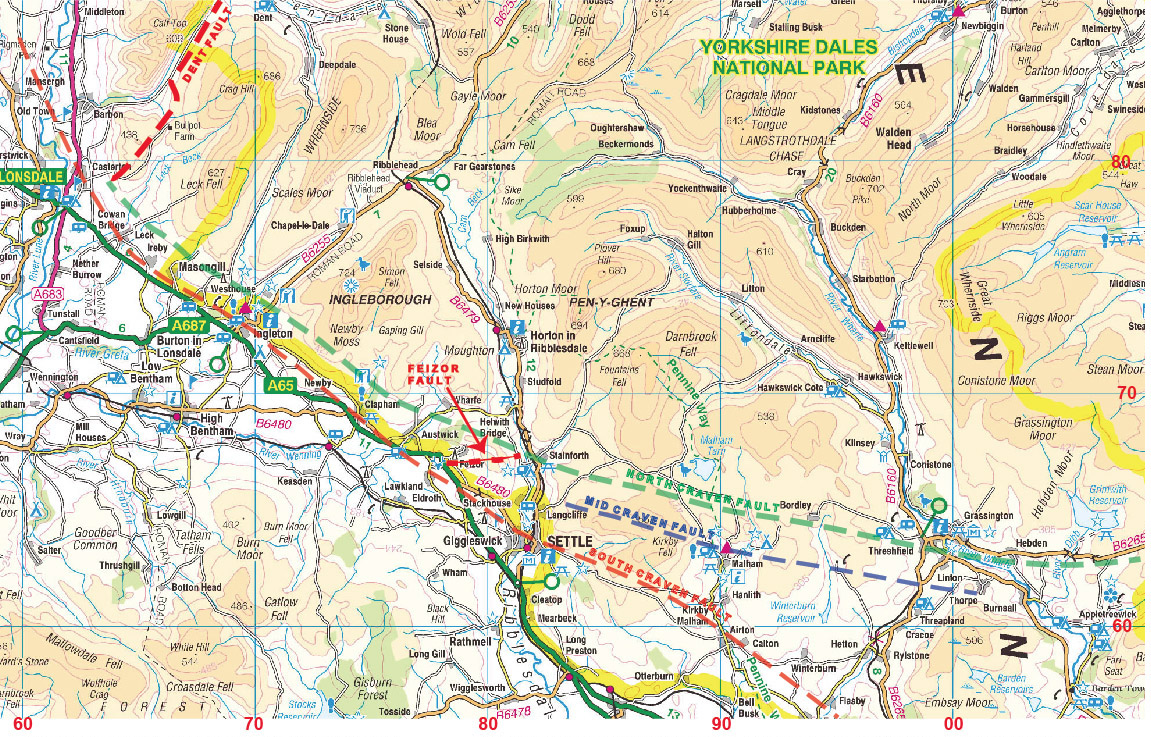
Topographical map sourced from www.mapmoose.com: "The Yorkshire Dales".
Map contains Ordnance Survey Data, Crown Copyright and Database Right 2011.
Compiled by Steve Warren, Skipton, August 2013.
Generalised map illustrating approximate locations of the major Craven Faults, the Feizor Fault and the Dent Fault. Sourced from British Geological Survey England and Wales Sheet 60 Settle, 1989, Sheet 50 Hawes, 1997, Geological Survey of England and Wales Sheet 98 SE 1892.
Craven Fault Country
Classical Craven Fault country: the effects of the Dent Fault are well seen in this dipping limestone strata at Blind Beck Bridge, Barbondale. May 25, 2012
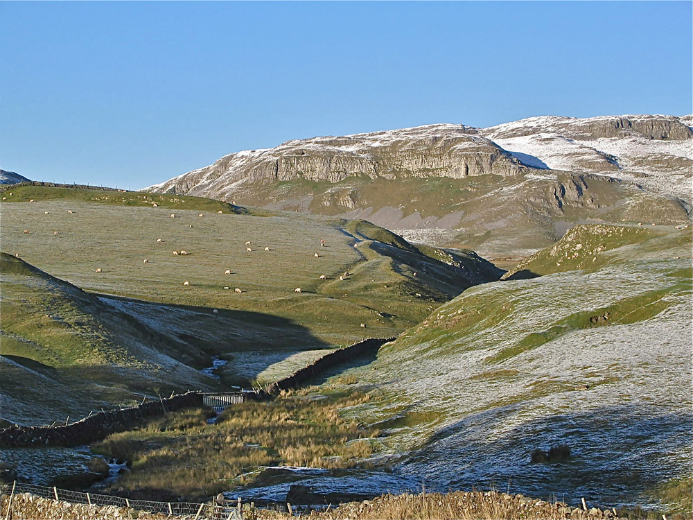
Classical Craven Fault country: looking over the lower part of Leck Fell towards Leck Beck, the Dent Fault crosses the middle ground and heads up north-east towards Bull Pot Farm and Barbondale. The limestone structures in the centre of the picture are the remains of a medieval or earlier farmstead. March 1, 2012
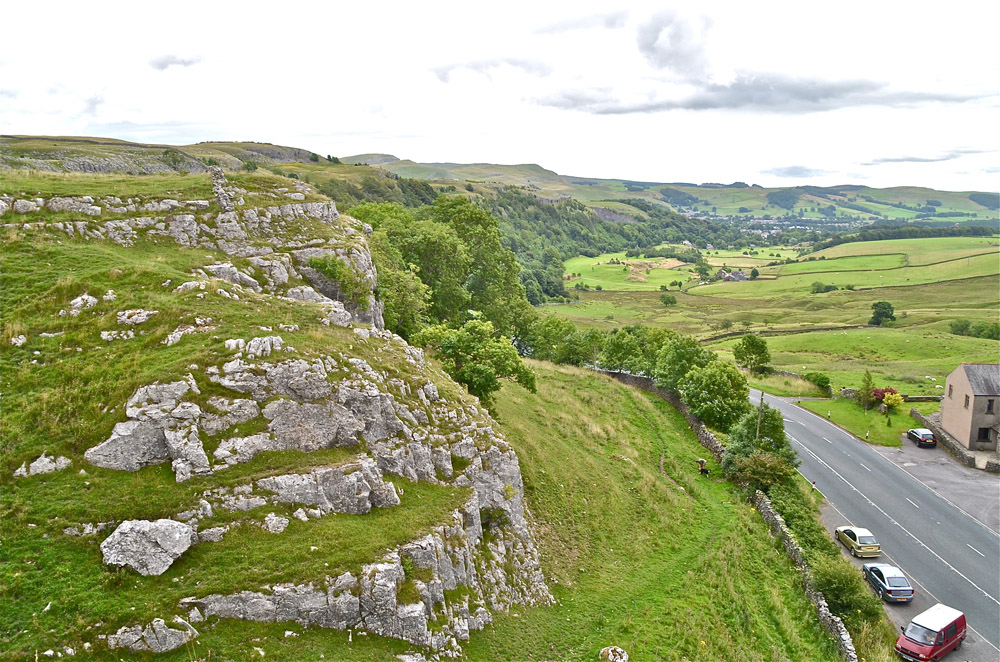
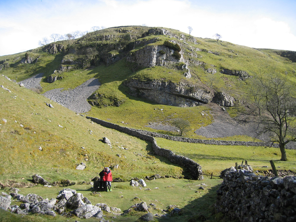
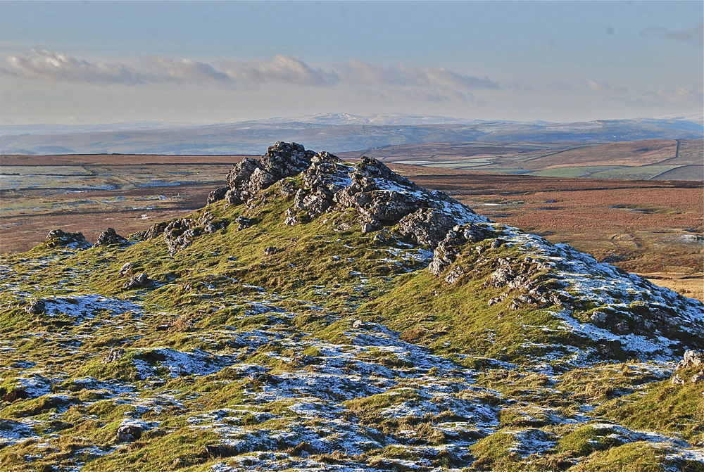
Classical Craven Fault country: this highly prominent feature on the North Craven Fault meets the eye on the approach to Kingsdale from Thornton in Lonsdale. October 22, 2005
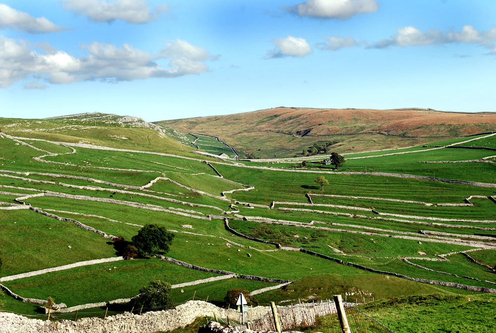
Classical Craven Fault country: from Twistleton one can look north west over the vast sheets of glacial moraine of lower Kingsdale with the North Craven Fault cutting across immediately to the left of the high limestone outcrop of Hunts Cross. August 10, 2013.
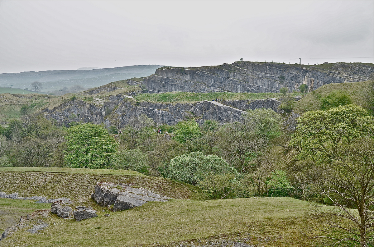
Classical Craven Fault country: the great quarries at Ingleton show many aspects of the Craven Fault. This scene from Meal Bank looks over the valley of the River Doe into the inclined strata of the North Craven Fault exposed by quarrying on Storrs Common. April 30, 2014.
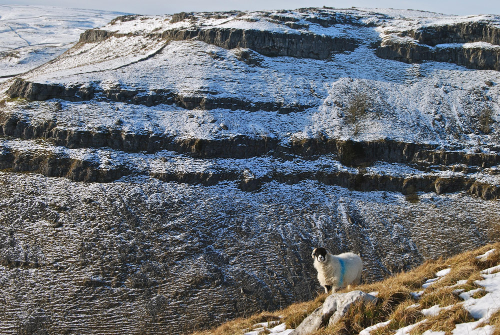
Classical Craven Fault country: looking along the North Craven Fault with Moughton Scars to the left and Jop Ridding to the right where Ordovician sandstones of the basement rocks are exposed. January 2, 2005
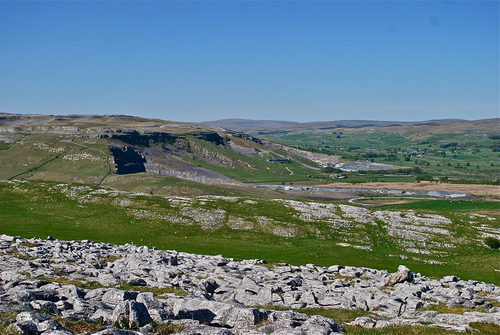
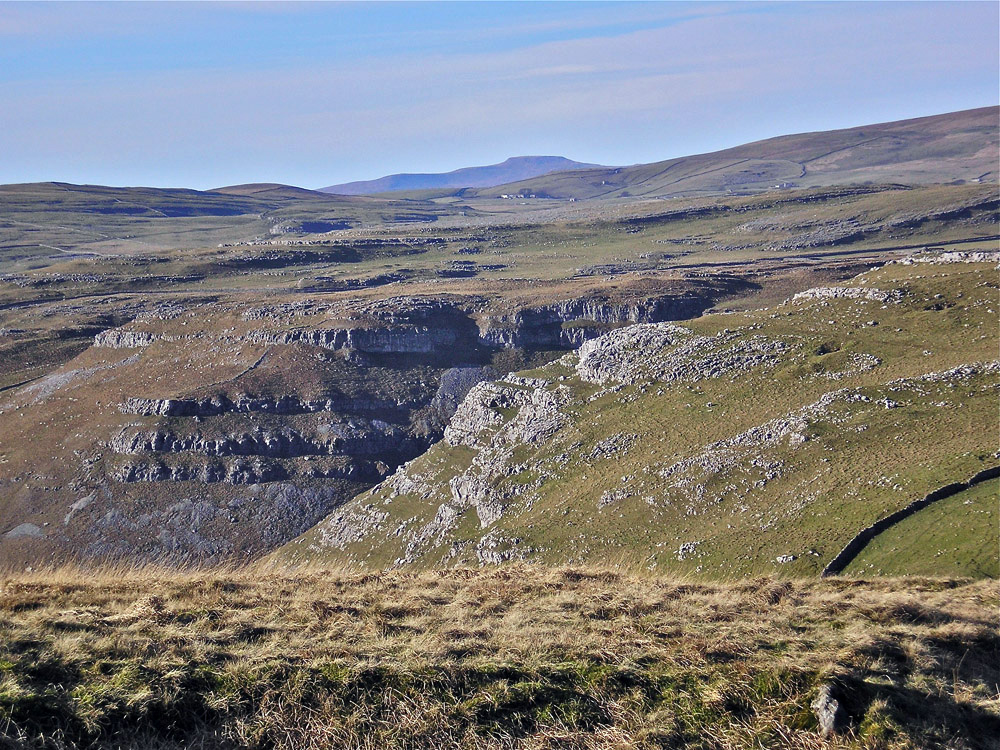
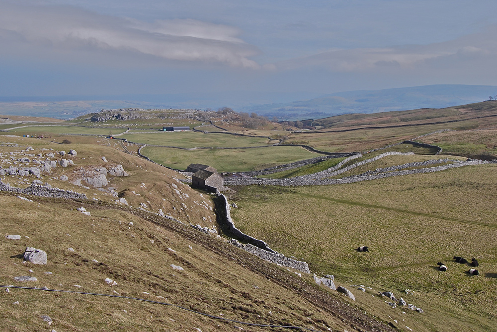
Classical Craven Fault country: the North Craven Fault crosses the middle ground with the earlier Helwith Bridge limestone quarry and the more recent roadstone quarry in the basement rocks. Horton in Ribblesdale in the distance. May 1, 2011.
Classical Craven Fault country: The South Craven Fault seen at Giggleswick Scar from Buckhaw Brow. August 10, 2013
Classical Craven Fault country: Attermire Scars with the South Craven Fault running across the low ground in front of the scars. November 11, 2004

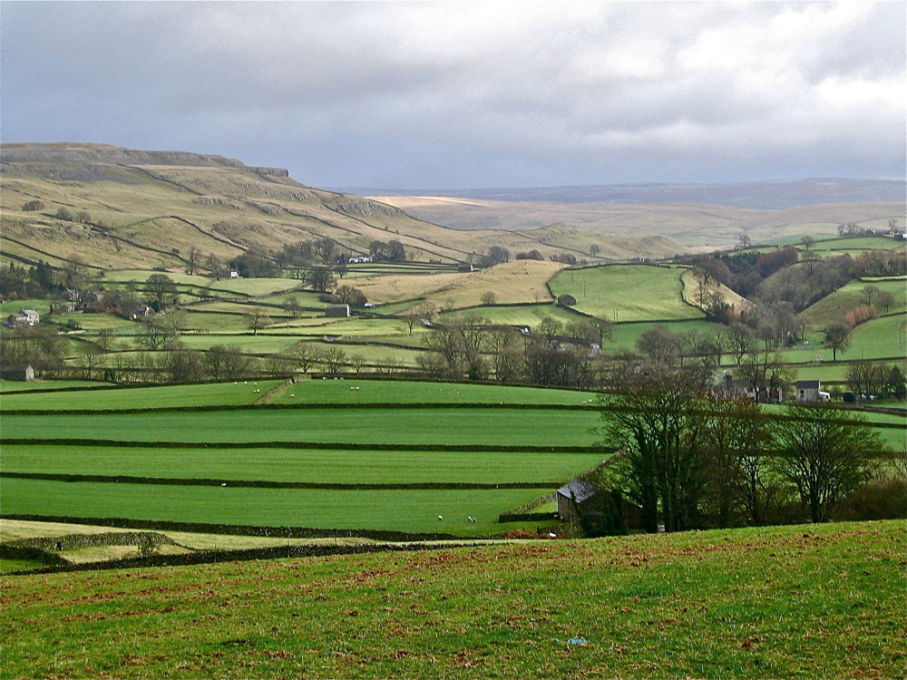
Classical Craven Fault country: the view from High Hills Lane looks over the Settle countryside with the South Craven Fault running approximately along the line of the road under High Hill to the right. Langdale Pikes in the distance. .November 11, 2004
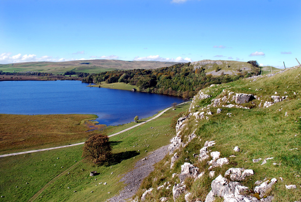
Classical Craven Fault country: Malham Tarn rests on the SIlurian basement rocks whilst the overlying Carboniferous limestone forms the scars of Great Close (immediate foreground) and High Folds (middle ground). Fountains Fell and the higher Yoredale Limestones overlain by Millstone grit are seen in the distance. October 4, 2010.

Classical Craven Fault country at its best, Malham Cove where the beginnings of the River AIre resurge after a long journey underground - through, along, or guided by, the Mid Craven Fault. August 8, 2007.
Classical Craven Fault country: Gordale Scar and part of Malham Moor from Weets Top, Ingleborough in the distance. July 31, 2004.
Classical Craven Fault country: looking along the Mid-Craven Fault over ancient field patterns from Cove Road, Malham. Great Knott to the left and Weets Top to the right with Gordale Lane - Hawthorns Lane upper centre. February 1, 2010
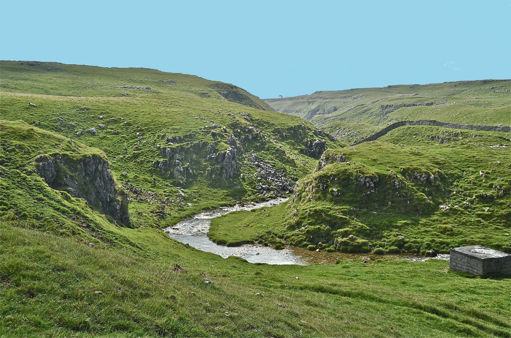
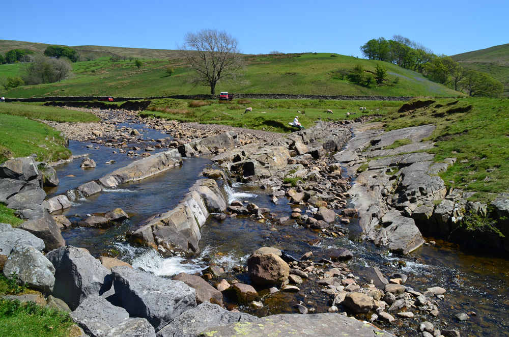
Classical Craven Fault country: The North Craven Fault grossly distorts the limestone strata where it crosses Gordale Beck close to Mastiles Lane. A powerful glacial meltwater stream has carved a deep channel through the fractured limestone. The ground behind the camera is the basement rocks shown in the next image. August 25, 2013.
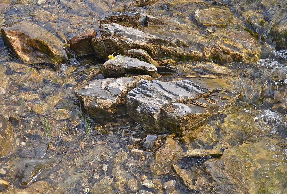
Classical Craven Fault country: Silurian basement rock in a stream section adjacent to the Gordale Beck crossing. August 11, 2013
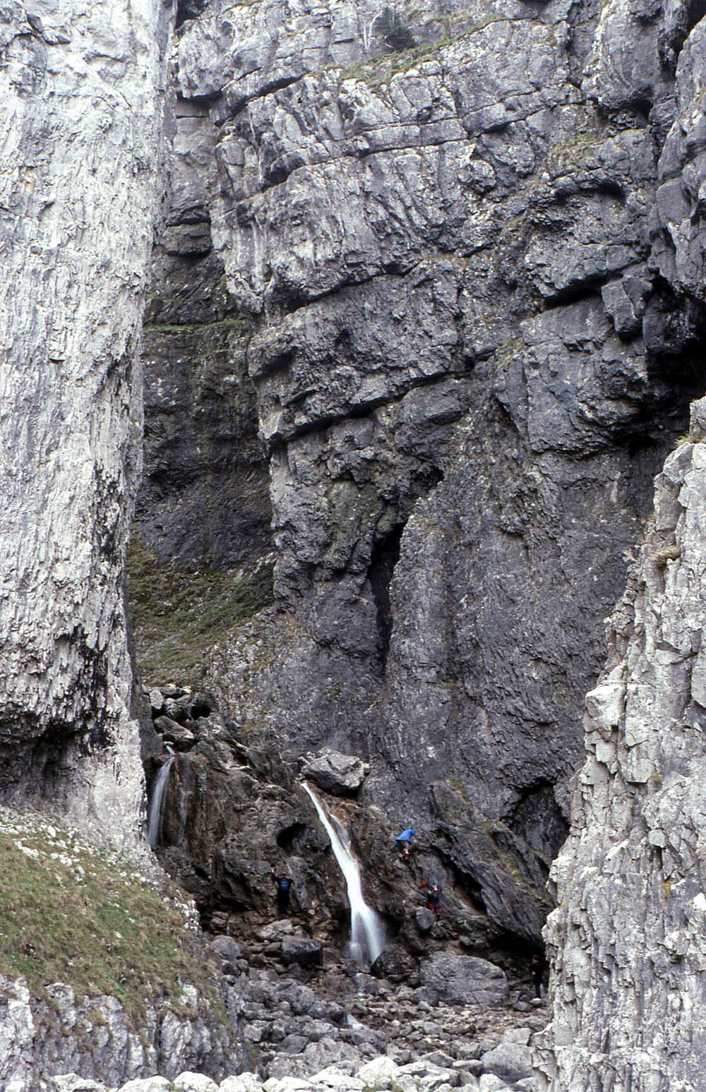
Classical Craven Fault country: The cascades of Gordale Scar allow one to penetrate deep inside the Great Scar Limestone, without going underground. This is the limestone massif between the Mid Craven Fault and the North Craven Fault. October 1995
Classical Craven Fault country: Gordale Scar reveals the layered nature of the Great Scar Limestone in this view from Great Knott, immediately to the north of the Mid Craven Fault. November 11, 2012
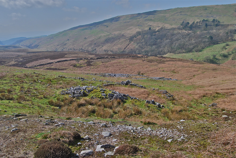
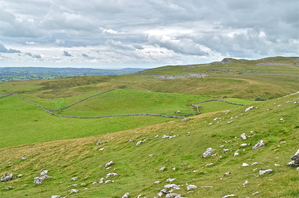
Classical Craven Fault country: Across the ancient field patterns of Higher Heights and Heights Laithe on the southern margins of Malham Moor, the North Craven Fault clearly divides the limestone terrain to the left from the shale and gritstone ground underlying the peat moorland of Boss Moor to the right. March 16, 2012

Classical Craven Fault country: This view from the Linton fields encompasses the Mid and North Craven Faults in the nearer ground, as well as the Netherside Gorge, Kilnsey Coolscar Quarry and Great Whernside. It also incidentally encompasses much of the ground in which the SIlurian erratics can be found. March 18, 2012
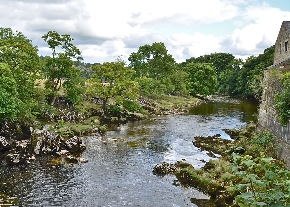
Classical Craven Fault country: The Mid Craven Fault turns down the limestone strata in the centre of this scene at Linton Falls. August 11, 2013
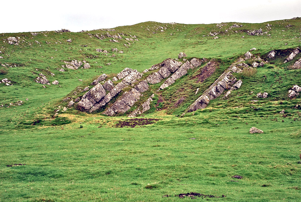
Classical Craven Fault country: Trollers Gill with major displacements of the strata by the Skyreholme anticline. April 15, 2008
Classical Craven Fault country: Nussey Knot, (Nursery Knot) a far flung outpost of the Craven Faults. The North Craven Fault peters out around this point and gives way to the Greenhow Anticline. Fountains Fell and Penyghent in the background. December 8, 2011.
Simpson's Maps
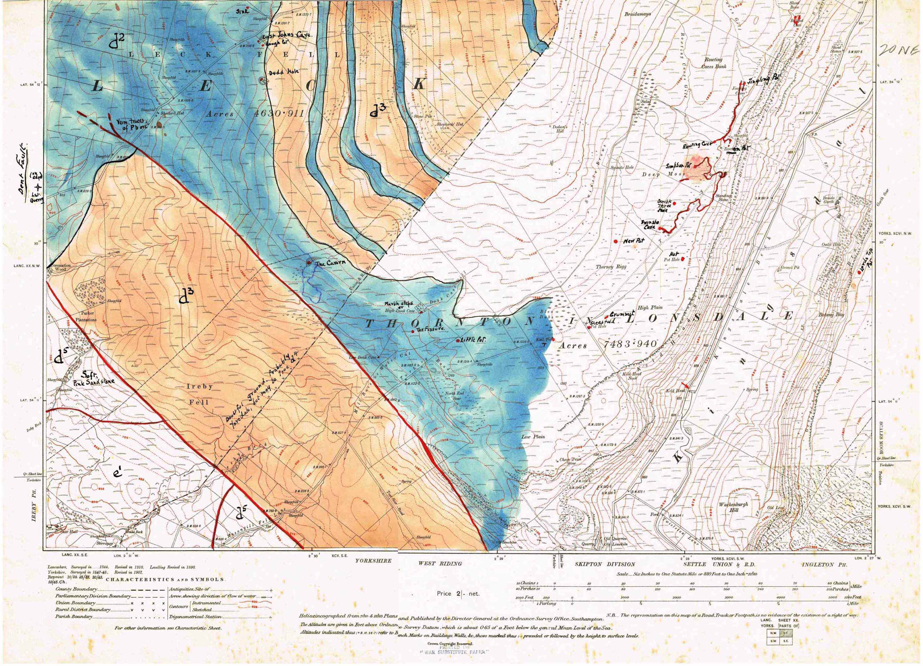
Eli SImpson could see there was a correlation between the occurence of faults and the disposition of the major cave systems. He spent some considerable time in working out these relationships by drawing the geology onto the six inch OS sheets of 1911 and 1919.
Click on images for larger view: use back arrow to return from image view.
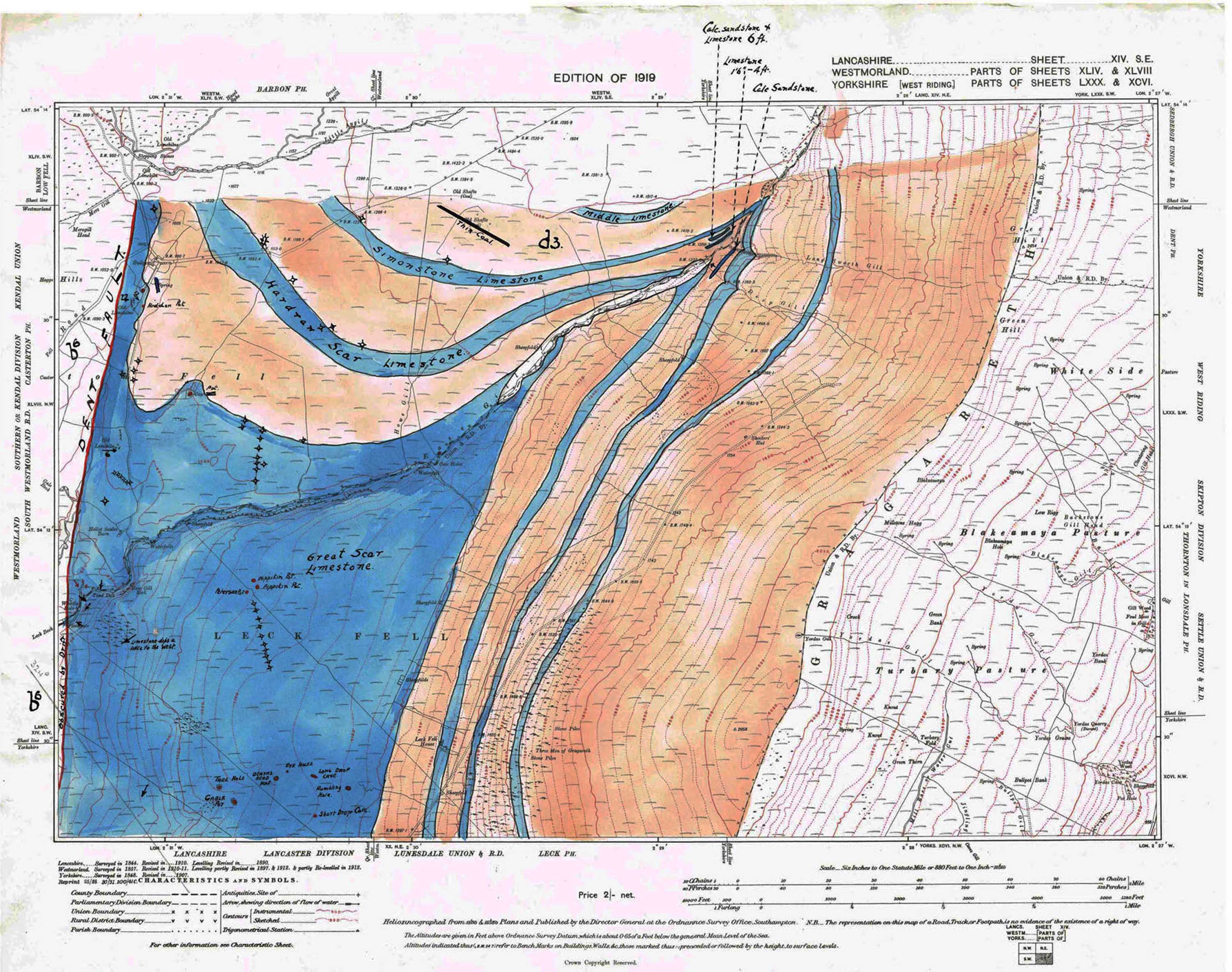
Left: Edition of 1919, Lancashire sheet 14SE, Westmorland parts of sheets 44 & 48, Yorkshire parts of sheets 80 & 96.
Right: Sheet 20NE, date unknown.
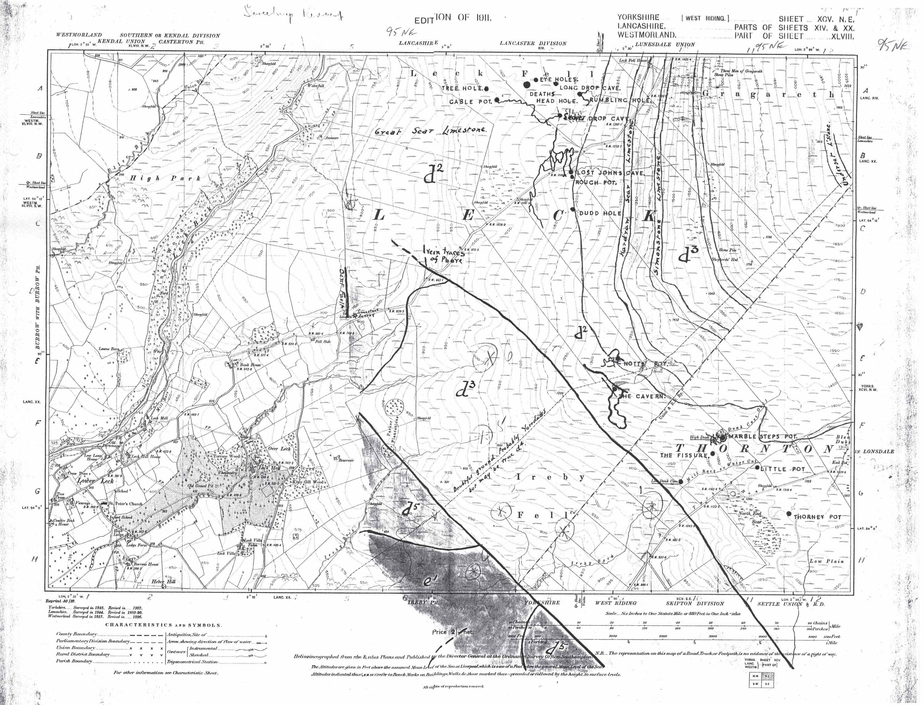
Left: Edition of 1911, Yorkshire sheet 95 NE, Lancashire parts of sheets 14 & 20, Westmorland part of sheet 48.
References
see references at bottom of Geology of Western Penyghent
Any
shortcomings in the text are entirely my
own.
If you would like to get in touch or add information, there is an email
address:
mudinmyhair@btinternet.com
Steve Warren
Website
created by WarrenAssociates 2012
Website hosted by Tsohost
Copyright © Steve Warren 2012